How to start hiking in Northwest Arkansas.

Which trails to hike at Back 40—and which not to
This is every trail in the system, all 23 of them. If you are putting together your own route, stay on the ones in the “Good to Hike” list.
Good to hike
22 trails
Hike any of these
- Back 40 Loop
- Back 40-Sugar Connector
- Brittany Dam
- Buckingham Cutoff
- Flo Ride
- It'll Bluff Out
- It'll Bluff Out High Line (North)
- It'll Bluff Out High Water Bypass
- It'll Bluff Out Shortcut (North)
- Lookout
- Merritt Circle
- Mulligan
- Pinyon Creek
- Rago
- SBAT
- Skiptown
- Summit School
- Taylor Homestead
- The Ledges
- Tower Trail
- Trafalgar Kingsland Sidepath
- What the Chuck
Don’t hike
1 trails
Don’t hike any of these
- Go Ride
A trail lands on the don’t hike list for one of three reasons. Some are posted bike-only, and that is almost always because of what the trail is—a gravity or downhill line where the traffic moves one way and moves fast. Others are technically open to foot traffic, but due to the nature of the trail, putting hikers and bikers on the trail together is dangerous, so avoiding them is our recommendation. And a few are perfectly fine to hike but sit off on their own or run only a few hundred feet, so there is no real sense in hiking them.
Heading to another system? You can see every trail we have mapped in one place.
Too many options? Filter these by distance & difficulty →

Bella Vista Museum to Lake Rayburn Waterfall
0.6 mi · 50 ft gain · 83 ft/mi · Loop · Bella Vista
Depending on the amount of recent rain, the waterfall may be too deep to safely cross without getting your shoes very wet.
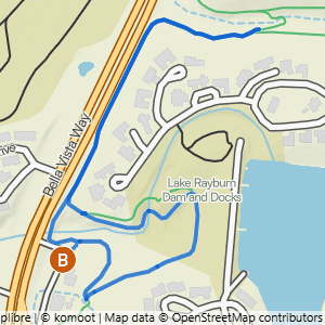
Bella Vista Museum to It'll Bluff Out Shortcut & Lake Rayburn Waterfall
1.17 mi · 100 ft gain · 85 ft/mi · Lollipop · Bella Vista

Snowbird
1.53 mi · 75 ft gain · 49 ft/mi · Loop · Bella Vista

Pinion Creek Falls to Trafalgar on Back 40
1.65 mi · 50 ft gain · 30 ft/mi · Out & Back · Bella Vista
Pinion Creek Falls is right next to the trailhead.

Pinion Creek Falls to Trafalgar
1.69 mi · 100 ft gain · 59 ft/mi · Out & Back · Bella Vista
Pinion Creek Falls is right next to the trailhead.

Pinion Creek Falls to Lancashire
1.94 mi · 175 ft gain · 90 ft/mi · Out & Back · Bella Vista
Pinion Creek Falls is right next to the trailhead.

Bella Vista Museum to It'll Bluff Out & Lake Rayburn Waterfall
2.01 mi · 150 ft gain · 75 ft/mi · Lollipop · Bella Vista

Bear Hollow to the Crack Shack
2.06 mi · 75 ft gain · 36 ft/mi · Out & Back · Bella Vista

Allen's to Berksdale South
2.2 mi · 25 ft gain · 11 ft/mi · Lollipop · Bella Vista

Power Station to Back 40 Taylor
2.21 mi · 150 ft gain · 68 ft/mi · Out & Back · Bella Vista

Lake Ann to Pinyon & Brittany Dam
2.23 mi · 150 ft gain · 67 ft/mi · Out & Back · Bella Vista

Metfield to Trafalgar on Rago
2.26 mi · 175 ft gain · 77 ft/mi · Out & Back · Bella Vista

Buckingham to Summit School
2.27 mi · 250 ft gain · 110 ft/mi · Lollipop · Bella Vista

Allen's to Berksdale South & Bluebird
2.32 mi · 25 ft gain · 11 ft/mi · Lollipop · Bella Vista

Snowbird Double-Ear Loop
2.45 mi · 100 ft gain · 41 ft/mi · Loop · Bella Vista

Tower Loop
2.58 mi · 225 ft gain · 87 ft/mi · Loop · Bella Vista
Some of this loop requires walking on the grass next to Bethnal Road, not on a defined trail. It does not require you to be immediately next to the road, but you may be walking through taller grass depending on the season, and perhaps needing to cross the road at times to get to better terrain.

Bella Vista Museum to It'll Bluff Out South & Dalton Dr.
2.79 mi · 100 ft gain · 36 ft/mi · Out & Back · Bella Vista

Metfield to Merritt Dr.
2.91 mi · 125 ft gain · 43 ft/mi · Out & Back · Bella Vista

Bella Vista Community Church to Pinion Creek Falls
3.13 mi · 225 ft gain · 72 ft/mi · Out & Back · Bella Vista

Pinion Creek Falls to Bella Vista Community Church
3.18 mi · 225 ft gain · 71 ft/mi · Out & Back · Bella Vista
Pinion Creek Falls is right next to the trailhead.

Pinion Creek Falls to It'll Bluff Out Lollipop
3.19 mi · 200 ft gain · 63 ft/mi · Lollipop · Bella Vista
Pinion Creek Falls is right next to the trailhead.

Bella Vista Museum to Pinion Creek Falls
3.22 mi · 175 ft gain · 54 ft/mi · Lollipop · Bella Vista

Metfield to Greenway & Rago Lollipop
3.22 mi · 150 ft gain · 47 ft/mi · Lollipop · Bella Vista

Lake Ann to Summit School
3.25 mi · 325 ft gain · 100 ft/mi · Out & Back · Bella Vista

Tower to Back 40
3.28 mi · 250 ft gain · 76 ft/mi · Out & Back · Bella Vista

Blowing Springs to Bomb Diggity, Back 40 & Low Ride
3.35 mi · 250 ft gain · 75 ft/mi · Loop · Bella Vista

Lake Ann to Flo Ride
3.35 mi · 375 ft gain · 112 ft/mi · Out & Back · Bella Vista
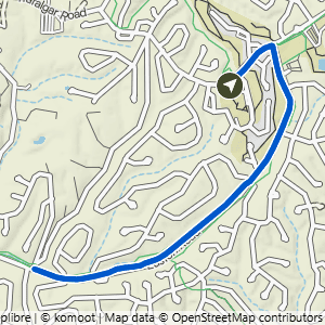
Metfield to Watson Dr.
3.36 mi · 150 ft gain · 45 ft/mi · Out & Back · Bella Vista

Bear Hollow to Back 40 West
3.51 mi · 300 ft gain · 85 ft/mi · Out & Back · Bella Vista

Power Station to Sister Ledges
3.65 mi · 200 ft gain · 55 ft/mi · Out & Back · Bella Vista

Bear Hollow to Bear Hollow Cave & Crack Shack
3.76 mi · 200 ft gain · 53 ft/mi · Out & Back · Bella Vista
The trail down to Bear Hollow Cave is extremely steep.

Bella Vista Museum to Buckingham
3.77 mi · 300 ft gain · 80 ft/mi · Out & Back · Bella Vista

Lake Ann to Summit School & B40
3.95 mi · 350 ft gain · 89 ft/mi · Out & Back · Bella Vista

Buckingham to Rago
3.98 mi · 375 ft gain · 94 ft/mi · Out & Back · Bella Vista
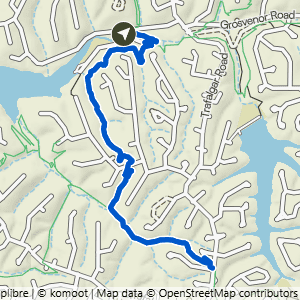
Lake Ann to Summit School & Rago
4.08 mi · 425 ft gain · 104 ft/mi · Out & Back · Bella Vista
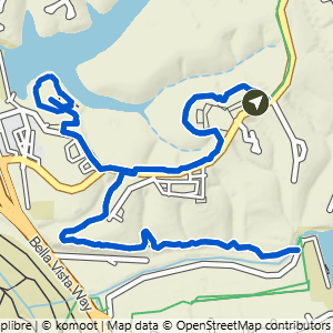
Bella Vista Community Church to Cooper Chapel & Pinion Creek Falls
4.1 mi · 275 ft gain · 67 ft/mi · Lollipop · Bella Vista

Buckingham to Pinion Creek Falls
4.14 mi · 325 ft gain · 79 ft/mi · Out & Back · Bella Vista

Lake Ann to Brittany Dam & Pinyon Creek
4.16 mi · 275 ft gain · 66 ft/mi · Out & Back · Bella Vista

Bear Hollow to Back 40 East
4.21 mi · 225 ft gain · 53 ft/mi · Out & Back · Bella Vista

Bear Hollow East & Crack Shack
4.4 mi · 225 ft gain · 51 ft/mi · Out & Back · Bella Vista

Lake Ann to Tip of the Spear
4.42 mi · 400 ft gain · 90 ft/mi · Lollipop · Bella Vista

Lake Ann to Summit School & Rago+
4.6 mi · 450 ft gain · 98 ft/mi · Out & Back · Bella Vista

Bella Vista Community Church to Pinion Creek Falls & Lookout+
4.87 mi · 325 ft gain · 67 ft/mi · Out & Back · Bella Vista
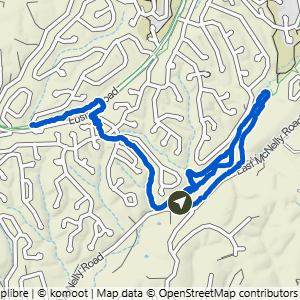
Snowbird to Back 40
4.93 mi · 300 ft gain · 61 ft/mi · Lollipop · Bella Vista

Allen's to It'll Bluff Out & Lake Rayburn Waterfall
4.96 mi · 200 ft gain · 40 ft/mi · Lollipop · Bella Vista
Depending on the amount of recent rain, the waterfall may be too deep to safely cross without getting your shoes very wet.

Bella Vista Community Church to Cooper Chapel & Lookout
4.96 mi · 350 ft gain · 71 ft/mi · Lollipop · Bella Vista

Buckingham to It'll Bluff Out
4.98 mi · 400 ft gain · 80 ft/mi · Lollipop · Bella Vista

Power Station to Double Ledges Loop
5.08 mi · 325 ft gain · 64 ft/mi · Loop · Bella Vista

Buckingham to Trafalgar
5.12 mi · 475 ft gain · 93 ft/mi · Lollipop · Bella Vista
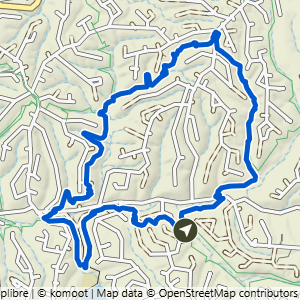
Power Station to Taylor Homestead & SBAT Loop
5.37 mi · 425 ft gain · 79 ft/mi · Loop · Bella Vista

Pinion Creek Falls to Back 40 & Tip of the Spear
5.38 mi · 425 ft gain · 79 ft/mi · Lollipop · Bella Vista
Pinion Creek Falls is right next to the trailhead.
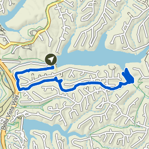
Pinion Creek Falls to Tip of the Spear
5.42 mi · 475 ft gain · 88 ft/mi · Lollipop · Bella Vista
Pinion Creek Falls is right next to the trailhead.
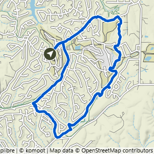
Metfield to Happy Hour Loop
5.46 mi · 300 ft gain · 55 ft/mi · Loop · Bella Vista

Bear Hollow Loop West
5.56 mi · 525 ft gain · 94 ft/mi · Loop · Bella Vista

Power Station to Double Ledges Lollipop
5.75 mi · 350 ft gain · 61 ft/mi · Lollipop · Bella Vista

Snowbird to Happy Hour Loop
5.82 mi · 300 ft gain · 52 ft/mi · Lollipop · Bella Vista
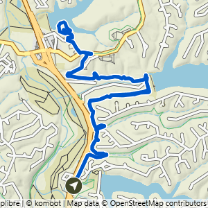
Bella Vista Museum to Cooper Chapel
5.99 mi · 425 ft gain · 71 ft/mi · Lollipop · Bella Vista

Metfield to Blowing Springs
6.02 mi · 275 ft gain · 46 ft/mi · Out & Back · Bella Vista

Bella Vista Museum to It'll Bluff Out South
6.18 mi · 450 ft gain · 73 ft/mi · Out & Back · Bella Vista

Lake Ann SBAT & Taylor Lollipop
6.32 mi · 475 ft gain · 75 ft/mi · Lollipop · Bella Vista

Metfield to Lambeth
6.42 mi · 300 ft gain · 47 ft/mi · Out & Back · Bella Vista
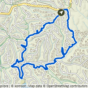
Tower South Loop
6.51 mi · 525 ft gain · 81 ft/mi · Loop · Bella Vista
Some of this loop requires walking on the grass next to Bethnal Road, not on a defined trail. It does not require you to be immediately next to the road, but you may be walking through taller grass depending on the season, and perhaps needing to cross the road at times to get to better terrain.

Snowbird Loop & Happy Hour Loop
6.52 mi · 350 ft gain · 54 ft/mi · Loop · Bella Vista

Bella Vista Museum to Tip of the Spear
6.56 mi · 575 ft gain · 88 ft/mi · Lollipop · Bella Vista

Bella Vista Community Church to the Cave
6.57 mi · 525 ft gain · 80 ft/mi · Out & Back · Bella Vista
The trail down to Bear Hollow Cave is extremely steep.

Metfield to Rago Loop
6.83 mi · 525 ft gain · 77 ft/mi · Loop · Bella Vista

Bear Hollow Loop East
6.86 mi · 500 ft gain · 73 ft/mi · Loop · Bella Vista

Buckingham to Cooper Chapel
6.89 mi · 550 ft gain · 80 ft/mi · Lollipop · Bella Vista

Bella Vista Community Church to the Cave & Mildenhall
6.94 mi · 575 ft gain · 83 ft/mi · Out & Back · Bella Vista
The trail down to Bear Hollow Cave is extremely steep.

Metfield to Happy Hour Loop & Snowbird
7 mi · 375 ft gain · 54 ft/mi · Loop · Bella Vista

Lake Ann Loop East
7.46 mi · 625 ft gain · 84 ft/mi · Loop · Bella Vista

Bear Hollow to Flo Ride & SBAT
7.61 mi · 675 ft gain · 89 ft/mi · Loop · Bella Vista

Lake Ann to Summit, Rago, Mulligan, Sister Ledges & Pinyon
7.78 mi · 625 ft gain · 80 ft/mi · Loop · Bella Vista

Lake Ann to Pinyon Creek & Double Ledges
8.7 mi · 550 ft gain · 63 ft/mi · Lollipop · Bella Vista

Bear Hollow East to Back 40 & SBAT
8.78 mi · 625 ft gain · 71 ft/mi · Loop · Bella Vista

Metfield to Rago, Pinyon Creek & Ledges
8.91 mi · 650 ft gain · 73 ft/mi · Loop · Bella Vista

Buckingham Loop South
8.92 mi · 800 ft gain · 90 ft/mi · Loop · Bella Vista

Power Station Loop South
8.92 mi · 650 ft gain · 73 ft/mi · Loop · Bella Vista

Bear Hollow to Back 40, Skipton & Flo Ride
9.67 mi · 775 ft gain · 80 ft/mi · Loop · Bella Vista

Buckingham Loop with Lake Rayburn Waterfall
9.83 mi · 875 ft gain · 89 ft/mi · Loop · Bella Vista
Depending on the amount of recent rain, the waterfall may be too deep to safely cross without getting your shoes very wet.

Metfield Big Loop South
9.94 mi · 700 ft gain · 70 ft/mi · Loop · Bella Vista

Bella Vista Museum Loop East
10.2 mi · 900 ft gain · 88 ft/mi · Loop · Bella Vista

Bear Hollow Big Loop
10.6 mi · 850 ft gain · 80 ft/mi · Loop · Bella Vista

Lake Ann Butterfly Loop
10.6 mi · 900 ft gain · 85 ft/mi · Loop · Bella Vista
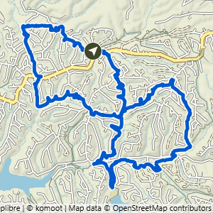
Bear Hollow Skip Town Figure 8
10.9 mi · 950 ft gain · 87 ft/mi · Loop · Bella Vista

Buckingham Loop South+
10.9 mi · 975 ft gain · 89 ft/mi · Loop · Bella Vista

Buckingham to Ledges Lollipop
11 mi · 850 ft gain · 77 ft/mi · Lollipop · Bella Vista

Lake Ann Loop West
11 mi · 975 ft gain · 89 ft/mi · Loop · Bella Vista

Buckingham Loop North
11.5 mi · 975 ft gain · 85 ft/mi · Loop · Bella Vista

Lake Ann Butterfly Lollipop
11.6 mi · 975 ft gain · 84 ft/mi · Lollipop · Bella Vista

Lake Ann to B40, Flo Ride, Skipton & SBAT
12.6 mi · 1075 ft gain · 85 ft/mi · Loop · Bella Vista

Bear Hollow to Back 40, Summit & SBAT Loop
13.1 mi · 1075 ft gain · 82 ft/mi · Loop · Bella Vista
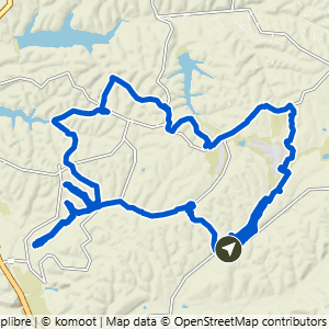
Snowbird Mega Loop
14.1 mi · 1025 ft gain · 73 ft/mi · Loop · Bella Vista

Lake Ann Wide North Loop
15.8 mi · 1300 ft gain · 82 ft/mi · Loop · Bella Vista

Bear Hollow Mega Loop
16.7 mi · 1250 ft gain · 75 ft/mi · Loop · Bella Vista