How to start hiking in Northwest Arkansas.
Back 40 · Bella Vista
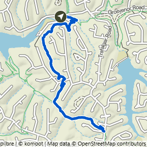
Lake Ann Butterfly Lollipop
Moderate
The route
This route is part of the Back 40 trail system. Open the full turn-by-turn map, elevation profile, and offline download in Komoot.


Where to park
Lake Ann Trailhead
Address
Back 40 Trails, 1 Wem Ln, Bella Vista, AR 72714Google code is FQGQ+94Q Bella Vista, AR
Open trailhead in Google MapsParking Area
medium, paved
Amenities
portable toilet
What to expect
Moderate routes like this one include natural-surface trails that are often about 2 feet wide. The trails can have moderate slopes/inclines, with some sections being quite steep. Obstacles may include rocks and roots up to about 8 inches high, so hikers should have good stability.
More routes from this trailhead
16 other routes start from Lake Ann Trailhead.

Lake Ann to Pinyon & Brittany Dam
2.23 mi · 150 ft gain · 67 ft/mi · Out & Back · Bella Vista

Lake Ann to Summit School
3.25 mi · 325 ft gain · 100 ft/mi · Out & Back · Bella Vista

Lake Ann to Flo Ride
3.35 mi · 375 ft gain · 112 ft/mi · Out & Back · Bella Vista

Lake Ann to Summit School & B40
3.95 mi · 350 ft gain · 89 ft/mi · Out & Back · Bella Vista
Lake Ann to Summit School & Rago
4.08 mi · 425 ft gain · 104 ft/mi · Out & Back · Bella Vista

Lake Ann to Brittany Dam & Pinyon Creek
4.16 mi · 275 ft gain · 66 ft/mi · Out & Back · Bella Vista