
Navigating the Trails: How to Use Komoot
Every route on hikenwa.org is built in Komoot, a hiking and navigation app, and our hike leads use it to navigate on the trail. This page explains why we use it, how to set it up for free, and how to follow along with every route we publish.
Why Komoot · Free for Local Hiking · Getting Set Up · Follow Hike NWA · Prefer a Different App? · Collections
Why we use Komoot

Komoot works like Google Maps for the trail. Open one of our routes, tap Navigate, and it gives you turn-by-turn directions as you hike—including voice navigation, so your phone can stay in your pocket.
It also shows exactly where you are on the route at all times, works offline once your region’s maps are downloaded (handy where cell service gets spotty), and displays useful planning details like elevation profiles and trail surfaces. Because our whole route library lives there, the route you see on hikenwa.org is exactly the route your phone will guide you along.
Free for local hiking
A free Komoot account lets you browse and plan routes anywhere in the world. To navigate and record hikes, Komoot uses one-time regional map unlocks—and every new account gets one region free. Choose the region that covers Bentonville and Bella Vista (called the Benton region), and everything you need for our trails—turn-by-turn navigation, voice guidance, offline maps, and hike recording—is free for good. There is no subscription required for local hiking, though Komoot offers optional paid map packs and a Premium tier if you want more.
Getting set up
- Download Komoot from the App Store or Google Play and create a free account.
- Claim your free region. When Komoot offers you a free region, pick the one that covers Bentonville and Bella Vista. It’s best if you are physically in the region when you download Komoot so it doesn’t accidentally give you a region out of the area.
- Allow location access so the app can show where you are on the trail and guide you as you hike.
- Open any of our routes. Click View Route on Komoot on a route card anywhere on hikenwa.org and it opens right in the app—tap Navigate and go. The Get Directions button in Komoot will even drive you to the trailhead first.
Follow Hike NWA on Komoot

All of our routes are saved on our Komoot profile, komoot.com/user/hikenwa—the same routes you’ll find in our Route Library. Follow us there and you can browse every route we publish right inside the app, save your favorite routes to your own profile, and get to know the trails before you ever leave the house.
Prefer a different app?
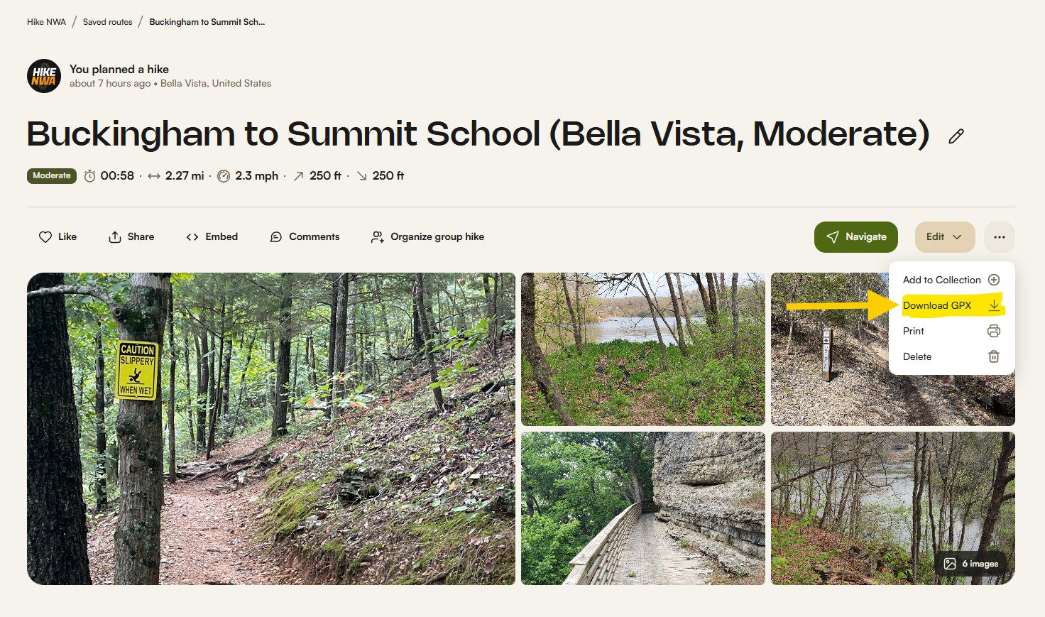
That’s okay! You can still use every route on this site with apps like AllTrails or Gaia GPS. Just open the route you want on Komoot.com, click the three dots in the top right corner, click Download GPX, then upload the GPX file to your preferred app to create the route there. GPX downloads work on free Komoot accounts—Komoot just requires the route’s region to be unlocked, and the free region you claim at signup covers all of our trails.
Our Komoot collections
We also group routes into Collections on Komoot—curated sets of related hikes you can browse as a group and save with one tap. It’s an easy way to keep a themed batch of hikes handy in the app.
Ready to put it to work?
Pick a hike from the Beginner’s Hiking Guide or the Route Library, tap View Route on Komoot, and hit the trail.