How to start hiking in Northwest Arkansas.
Lake Ann Trailhead
Parking for Back 40 · Bella Vista, AR
The Lake Ann Trailhead, near Lake Ann in Bella Vista, is one of the main ways into the Back 40. Routes from here run from about 2 miles to more than 15, with moderate and challenging climbs.
Where to Park

Address
Back 40 Trails, 1 Wem Ln, Bella Vista, AR 72714 (Or type FQGQ+94Q Bella Vista, AR directly into Google Maps.)
Get Directions to the TrailheadParking Area
medium, paved
Amenities
portable toilet

Lake Ann to Pinyon & Brittany Dam
2.23 mi · 150 ft gain · 67 ft/mi · Out & Back

Lake Ann to Flo Ride
3.13 mi · 350 ft gain · 112 ft/mi · Out & Back

Lake Ann to Summit School
3.25 mi · 325 ft gain · 100 ft/mi · Out & Back

Lake Ann to Summit School & B40
3.95 mi · 350 ft gain · 89 ft/mi · Out & Back
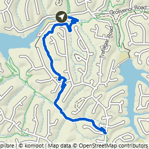
Lake Ann to Summit School & Rago
4.08 mi · 425 ft gain · 104 ft/mi · Out & Back

Lake Ann to Brittany Dam & Pinyon Creek
4.16 mi · 275 ft gain · 66 ft/mi · Out & Back

Lake Ann to Tip of the Spear
4.42 mi · 400 ft gain · 90 ft/mi · Lollipop

Lake Ann to Summit School & Rago+
4.6 mi · 450 ft gain · 98 ft/mi · Out & Back

Lake Ann SBAT & Taylor Lollipop
6.32 mi · 475 ft gain · 75 ft/mi · Lollipop

Lake Ann Loop East
7.46 mi · 625 ft gain · 84 ft/mi · Loop

Lake Ann to Summit, Rago, Mulligan, Sister Ledges & Pinyon
7.78 mi · 625 ft gain · 80 ft/mi · Loop

Lake Ann to Pinyon Creek & Double Ledges
8.7 mi · 550 ft gain · 63 ft/mi · Lollipop

Lake Ann Butterfly Loop
10.6 mi · 900 ft gain · 85 ft/mi · Loop

Lake Ann Loop West
11 mi · 975 ft gain · 89 ft/mi · Loop

Lake Ann Butterfly Lollipop
11.6 mi · 975 ft gain · 84 ft/mi · Lollipop

Lake Ann to B40, Flo Ride, Skipton & SBAT
12.6 mi · 1075 ft gain · 85 ft/mi · Loop

Lake Ann Wide North Loop
15.71 mi · 1300 ft gain · 83 ft/mi · Loop