The Beginner’s Guide to Hiking Northwest Arkansas—3-Mile Edition
52 hikes · about 3 miles or less each · one a week for a full year
How to use this guide
- Start where you’re comfortable. Brand new to hiking? Begin with Paved hike #1. Already walking trails? Jump in wherever feels right.
- Check off each hike as you finish it. Your progress saves automatically in your browser—no account or sign-in needed. As you check hikes off, you’ll see the progress bars fill in. Each level has its own bar, and the black bar at the top of the page tracks the whole guide. Just note that your checkmarks are saved in this browser on this device, so if you clear your browsing data or switch devices, your checkmarks will start fresh.
- Move up when it feels easy. When you can finish the hikes at one level comfortably, you’re ready for the next level.
Here’s a quick look at what each part of a route card tells you.
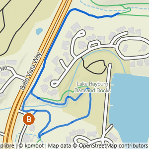
- 1Difficulty → the badge color and label show the route’s level. Tap it on a real card to see what each level means
- 2Route name → tap it to open the route’s own page
- 3Distance → how far the whole hike is
- 4Gain → the total feet of climbing across the hike
- 5Steepness → feet of climbing per mile. Bigger numbers mean a steeper, tougher hike
- 6Route shape → a loop returns to where it started, an out & back turns around and retraces the same path, and a lollipop is a loop with a there-and-back stretch at one end
- 7Heads-up tags → things to know before you go, like a water crossing, a waterfall, or rocky ground. Not every route has them
- 8Route note → a tip about something specific on this route. Not every route has one
- 9View Route Details & Photos → opens the route’s page, with a photo walkthrough of the whole route, where to park, and the trails it uses
- 10View Trailhead Details → opens the trailhead page with parking details and directions
- 11View Route on Komoot → opens the route in the free Komoot app so you can follow it as you hike
- 12Mark complete → check it off when you finish and the progress bars fill in
Paved
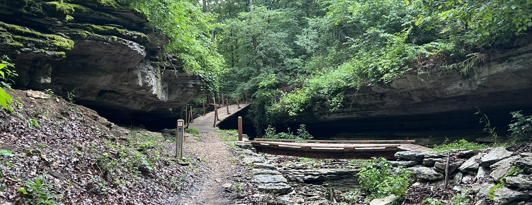
These routes are on smooth, hard-surface paths that are typically 6 feet or more wide, with no rocks or roots to navigate. The slope of the trail can vary, with some being nearly flat and others having noticeable inclines and hills. See examples of what these trails look like.

Bluebird to Berksdale South Double Lollipop
1.84 mi · 25 ft gain · 14 ft/mi · Lollipop

Osage Park 1.9
1.89 mi · 0 ft gain · 0 ft/mi · Lollipop

Veterans on the Greenway
2.56 mi · 25 ft gain · 10 ft/mi · Out & Back

Allen's to Berksdale South
2.2 mi · 25 ft gain · 11 ft/mi · Lollipop

Coler South to Coler North
2.99 mi · 75 ft gain · 25 ft/mi · Out & Back

Blue Hole to Slaughter Pen
2.61 mi · 100 ft gain · 38 ft/mi · Lollipop
This route has a section with some more challenging up-and-down climbing for part of the return section.
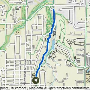
Compton Gardens to Cub Circle
1.96 mi · 200 ft gain · 102 ft/mi · Out & Back

Blowing Springs to West Euston
2.14 mi · 100 ft gain · 47 ft/mi · Out & Back
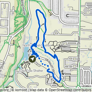
Crystal Bridges to Forest Trail
1.68 mi · 100 ft gain · 60 ft/mi · Loop

Metfield to Merritt Dr.
2.91 mi · 125 ft gain · 43 ft/mi · Out & Back

Branchwood Trail
1.52 mi · 125 ft gain · 82 ft/mi · Loop
While this is a very nice paved trail, it is also very hilly. Walking this route clockwise is generally easier elevation-wise than walking counter-clockwise, as the inclines are more gradual.

Northeast A St to Compton Gardens & Crystal Bridges
2.99 mi · 225 ft gain · 75 ft/mi · Lollipop
Easy
These routes are on natural-surface dirt or gravel trails that are about 3 feet wide or wider. The trail has gentle slopes with an average grade/incline of 5% or less and a generally stable surface. See examples of what these trails look like.
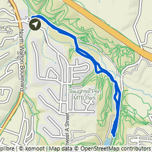
Hidden Springs to All-American & Greenway
2.99 mi · 100 ft gain · 33 ft/mi · Loop
This route includes about 1.75 miles of paved Greenway.

Veterans to Flash Flood & All-American
1.47 mi · 25 ft gain · 17 ft/mi · Loop

Snowbird
1.53 mi · 75 ft gain · 49 ft/mi · Loop

Tweety Bird
1.74 mi · 75 ft gain · 43 ft/mi · Loop

Coler South to Lor-Axe West
2.2 mi · 100 ft gain · 45 ft/mi · Lollipop
This route includes about .5 miles on the paved Applegate Trail.

Lake Avalon to Lago Vista West
2.64 mi · 150 ft gain · 57 ft/mi · Out & Back
Moderate
These routes include natural-surface trails that are often about 2 feet wide. The trails can have moderate slopes/inclines, with some sections being quite steep. Obstacles may include rocks and roots up to about 8 inches high, so hikers should have good stability. Most trails in Northwest Arkansas are rated moderate, so finishing this level means the region is yours. It’s split into three stages so you can feel your progress. See examples of what these trails look like.
Moderate I

Bear Hollow to the Crack Shack
2.06 mi · 75 ft gain · 36 ft/mi · Out & Back

Snowbird Double-Ear Loop
2.45 mi · 100 ft gain · 41 ft/mi · Loop

Kingswood to Riordon Tunnel
1.77 mi · 75 ft gain · 42 ft/mi · Out & Back

Scotsdale to the Bridge
2.19 mi · 125 ft gain · 57 ft/mi · Out & Back
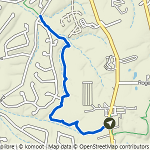
Bella Vista Police Department to Highlands
2.63 mi · 150 ft gain · 57 ft/mi · Out & Back

Down Under Water Tower to Tweety Tunnel
2.3 mi · 150 ft gain · 65 ft/mi · Out & Back

Gear Garden to Low Ride
2.19 mi · 150 ft gain · 68 ft/mi · Loop

Lake Ann to Pinyon & Brittany Dam
2.23 mi · 150 ft gain · 67 ft/mi · Out & Back

Power Station to Back 40 Taylor
2.21 mi · 150 ft gain · 68 ft/mi · Out & Back
Moderate II

Tanyard Creek & Tunnel Vision
2.5 mi · 175 ft gain · 70 ft/mi · Loop

Bella Vista Community Church to Pinion Creek Falls
3.21 mi · 225 ft gain · 70 ft/mi · Out & Back

Wonderland to Mighty Pine Loop
2.71 mi · 200 ft gain · 74 ft/mi · Loop

Kingsdale Loop North
2.3 mi · 175 ft gain · 76 ft/mi · Loop

Metfield to Trafalgar on Rago
2.26 mi · 175 ft gain · 77 ft/mi · Out & Back

Pontoon Park to Highland Rd.
2.21 mi · 175 ft gain · 79 ft/mi · Out & Back

Hidden Springs to Armadillo, Jessie's Climb, Medusa & Tatamagouche
2.2 mi · 175 ft gain · 80 ft/mi · Loop
This route includes about .3 miles of paved Greenway.

Bella Vista AoG to Sherlock
2.42 mi · 200 ft gain · 83 ft/mi · Out & Back
Moderate III

Bluebird to Tavistock Loop & Snacks
2.37 mi · 200 ft gain · 84 ft/mi · Lollipop

Tower Loop
2.58 mi · 225 ft gain · 87 ft/mi · Loop
Some of this loop requires walking on the grass next to Bethnal Road, not on a defined trail. It does not require you to be immediately next to the road, but you may be walking through taller grass depending on the season, and perhaps needing to cross the road at times to get to better terrain.

Mace Lane to (Almost) Play Thru
2.29 mi · 200 ft gain · 87 ft/mi · Out & Back

Handcut Hollow @ J St to Short Traverse Loop
1.91 mi · 175 ft gain · 92 ft/mi · Loop

Buckingham to Summit School
2.27 mi · 250 ft gain · 110 ft/mi · Lollipop

London Drive Water Tower to Landline
2.28 mi · 250 ft gain · 110 ft/mi · Out & Back

Play Thru to Lake Avalon Vista
2.4 mi · 350 ft gain · 146 ft/mi · Out & Back

Chelsea & Arthur to Pontoon Park
2.12 mi · 300 ft gain · 142 ft/mi · Out & Back
Challenging
These routes include natural-surface trails that are often only 1 foot wide (or narrower) and have steep slopes with significant climbs and descents (15% grade or more). Frequent obstacles may include rocks and roots 15 inches high or taller. Hikers must have excellent stability. See examples of what these trails look like.

Veterans to All-American, Flash Flood, Smugglers & Sally
2.17 mi · 50 ft gain · 23 ft/mi · Loop
Sally specifically has a lot of rocky obstacles.

Bella Vista Museum to It'll Bluff Out & Lake Rayburn Waterfall
2.01 mi · 150 ft gain · 75 ft/mi · Lollipop

Cub Circle to Rocking Horse, Heading Home, and Apple Turnover
1.65 mi · 150 ft gain · 91 ft/mi · Loop

Bella Vista Museum to It'll Bluff Out South & Dalton Dr.
2.79 mi · 100 ft gain · 36 ft/mi · Out & Back
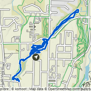
Park Springs to Burns, Black Apple & Rotten to the Core
3.04 mi · 150 ft gain · 49 ft/mi · Lollipop

Blowing Springs to Blowing Springs North & Bomb Diggity
2.11 mi · 150 ft gain · 71 ft/mi · Loop

ARC to Sick-A-More & Down Under South
2.64 mi · 200 ft gain · 76 ft/mi · Lollipop


Handcut Hollow @ the Schoolhouse to Sufferin' & Zones
2.57 mi · 375 ft gain · 146 ft/mi · Loop
🎉 You did it!
All 52 hikes. Every level, nearly every trailhead in Bella Vista and Bentonville. You’ve gone from pavement to the steepest trails in the region. Time to go longer—the route library has 300+ routes waiting.