Park Springs Trailhead

Parking for Slaughter Pen + Park Springs · Bentonville, AR

Park Springs Park is a small, historic park north of downtown Bentonville and one end of the Slaughter Pen and Park Springs trails. Routes from here run from about 2 to 5 miles and are rated moderate or challenging.

Where to Park

Parking area at Park Springs Trailhead in Bentonville, Arkansas - small, paved

Address

Park Springs Park, 300 NW 10th St, Bentonville, AR 72712 (Or type 9QMQ+J88 Bentonville, AR directly into Google Maps.)

Get Directions to the Trailhead

Parking Area

small, paved

Amenities

full restrooms

Routes From This Trailhead

8 routes start here, listed shortest first.

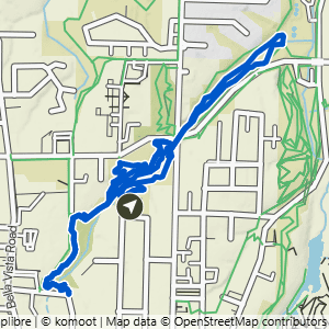
Route map for Park Springs to Black Apple & Burns, a 2.2-mile moderate hike in Bentonville, Arkansas

Park Springs to Black Apple & Burns

2.15 mi · 125 ft gain · 58 ft/mi · Loop

Water Crossing
Route map for Park Springs to Burns, Black Apple & Rotten to the Core, a 3-mile challenging hike in Bentonville, Arkansas

Park Springs to Burns, Black Apple & Rotten to the Core

3.04 mi · 150 ft gain · 49 ft/mi · Lollipop

Water Crossing
Route map for Park Springs to Burns & Black Apple, a 3.1-mile moderate hike in Bentonville, Arkansas

Park Springs to Burns & Black Apple

3.08 mi · 175 ft gain · 57 ft/mi · Loop

Water Crossing
Route map for Park Springs to Burns & Full Black Apple, a 3.3-mile moderate hike in Bentonville, Arkansas

Park Springs to Burns & Full Black Apple

3.27 mi · 150 ft gain · 46 ft/mi · Lollipop

Water Crossing
Route map for Park Springs to Black Apple, Burns & Heading Home, a 3.4-mile moderate hike in Bentonville, Arkansas

Park Springs to Black Apple, Burns & Heading Home

3.43 mi · 175 ft gain · 51 ft/mi · Lollipop

Water Crossing
Route map for Park Springs to Black Apple, Burns, Apple Turnover & Heading Home, a 3.5-mile challenging hike in Bentonville

Park Springs to Black Apple, Burns, Apple Turnover & Heading Home

3.49 mi · 175 ft gain · 50 ft/mi · Lollipop

Water Crossing
Route map for Park Springs to Black Apple, Heading Home, Rocking Horse & Burns, a 4.1-mile moderate hike in Bentonville

Park Springs to Black Apple, Heading Home, Rocking Horse & Burns

4.08 mi · 225 ft gain · 55 ft/mi · Lollipop

Water Crossing
Route map for Park Springs to Black Apple, Heading Home, Rocking Horse, Turnover & Burns, a 4.1-mile challenging hike in