How to start hiking in Northwest Arkansas.
Find a Hiking Route
Click LOAD ROUTES to see every route in the library—or use the filters to narrow things down more.

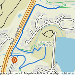
43 routes

Blowing Springs to Blowing Springs North & Bomb Diggity
2.11 mi · 150 ft gain · 71 ft/mi · Loop
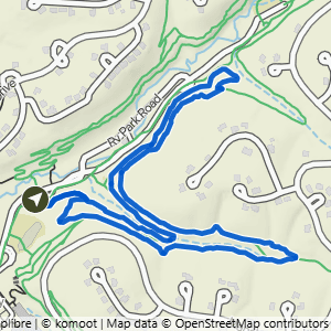
Blowing Springs to Low Ride
2.12 mi · 175 ft gain · 83 ft/mi · Loop

Blowing Springs to West Euston
2.14 mi · 100 ft gain · 47 ft/mi · Out & Back

Gear Garden to Low Ride
2.19 mi · 150 ft gain · 68 ft/mi · Loop

Blowing Springs to Low Ride & Blowing Springs North
2.69 mi · 225 ft gain · 84 ft/mi · Loop
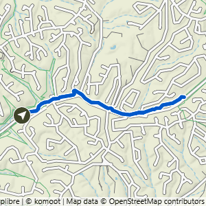
Gear Garden to Back 40
2.92 mi · 125 ft gain · 43 ft/mi · Out & Back

Blowing Springs to Mighty Pine
3.06 mi · 300 ft gain · 98 ft/mi · Loop

Lambeth LDS to Bomb Diggity & Blowing Springs North
3.11 mi · 275 ft gain · 88 ft/mi · Loop

Gear Garden to Greenway 5K
3.12 mi · 125 ft gain · 40 ft/mi · Out & Back

Gear Garden to Bomb Diggity & Blowing Springs South
3.13 mi · 200 ft gain · 64 ft/mi · Loop

Gear Garden to Blowing Springs North & Bomb Diggity
3.25 mi · 275 ft gain · 85 ft/mi · Loop

Blowing Springs to Mighty Pine
3.27 mi · 325 ft gain · 99 ft/mi · Loop

Gear Garden to Greenway East
3.31 mi · 150 ft gain · 45 ft/mi · Out & Back

Blowing Springs South & Back 40
3.34 mi · 200 ft gain · 60 ft/mi · Loop

Blowing Springs to Bomb Diggity, Back 40 & Low Ride
3.35 mi · 250 ft gain · 75 ft/mi · Loop

Blowing Springs to Sally, Smuggler's & All-American
3.36 mi · 250 ft gain · 74 ft/mi · Lollipop
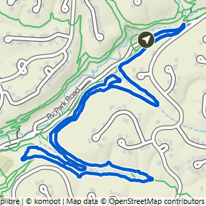
Gear Garden to Blowing Springs South & Low Ride
3.38 mi · 250 ft gain · 74 ft/mi · Lollipop

Gear Garden to Back 40, Bomb Diggity & Low Ride
3.38 mi · 250 ft gain · 74 ft/mi · Loop

Gear Garden to Back 40 & Greenway
3.39 mi · 200 ft gain · 59 ft/mi · Loop

Gear Garden to (Most of) Blowing Springs North & South
3.42 mi · 275 ft gain · 80 ft/mi · Loop

Gear Garden to Low Ride + Blowing Springs North
3.82 mi · 350 ft gain · 92 ft/mi · Loop
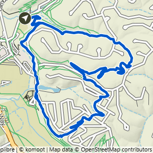
Blowing Springs to Rabbit Hole & Mighty Pine
3.88 mi · 375 ft gain · 97 ft/mi · Loop

Blowing Springs to Low Ride & Mighty Pine
3.9 mi · 375 ft gain · 96 ft/mi · Loop

Gear Garden to Back 40, Blowing Springs North & Bomb Diggity
4.02 mi · 325 ft gain · 81 ft/mi · Loop

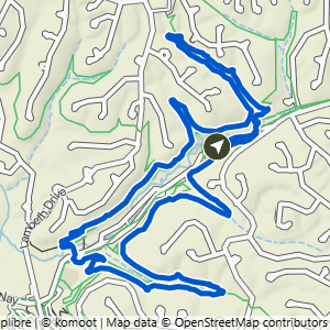

Lambeth LDS to Blowing Springs South & Low Ride
4.29 mi · 350 ft gain · 82 ft/mi · Loop

Blowing Springs to It'll Bluff Out
4.48 mi · 400 ft gain · 89 ft/mi · Out & Back

Blowing Springs to Low Ride, Cooper & Mighty Pine
4.48 mi · 400 ft gain · 89 ft/mi · Lollipop

Gear Garden to Back 40, Blowing Springs North, It'll Bluff Out & Bomb Diggity
4.49 mi · 425 ft gain · 95 ft/mi · Lollipop

Lambeth LDS to Back 40 & Full Blowing Springs Loop
4.99 mi · 450 ft gain · 90 ft/mi · Loop

Gear Garden to Blowing Springs, Low Ride & Mighty Pine
4.99 mi · 375 ft gain · 75 ft/mi · Lollipop

Blowing Springs to Bomb Diggity, It'll Bluff Out, Disco Stu & Blowing Springs North
5.66 mi · 500 ft gain · 88 ft/mi · Lollipop

Lambeth LDS to Blowing Springs North & Dalton Drive
5.73 mi · 625 ft gain · 109 ft/mi · Out & Back

Gear Garden to Blowing Spring North, It'll Bluff Out, Disco Stu & Bomb Diggity
6.26 mi · 525 ft gain · 84 ft/mi · Lollipop

Lambeth LDS to Back 40, Low Ride, Mighty Pine & Bomb Diggity
6.79 mi · 550 ft gain · 81 ft/mi · Loop

Blowing Springs to It'll Bluff Out at Kingsland
6.94 mi · 500 ft gain · 72 ft/mi · Out & Back

Gear Garden Loop East
7.07 mi · 525 ft gain · 74 ft/mi · Loop
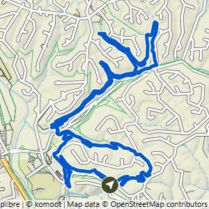
Wonderland to Bomb, Blowing Springs North & Mighty Pine
7.11 mi · 625 ft gain · 88 ft/mi · Loop

Gear Garden to Blowing Springs & Back40 Loop
7.12 mi · 550 ft gain · 77 ft/mi · Loop
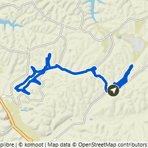
Snowbird to Back 40, Low Ride & Blowing Springs North
10.1 mi · 675 ft gain · 67 ft/mi · Lollipop

Gear Garden Loop North
10.7 mi · 800 ft gain · 75 ft/mi · Loop
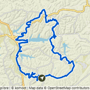
Gear Garden to Mega Loop North
17.8 mi · 1400 ft gain · 79 ft/mi · Loop