How to start hiking in Northwest Arkansas.
Find a Hiking Route
Click LOAD ROUTES to see every route in the library—or use the filters to narrow things down more.

What do the difficulty levels mean?
Routes marked PAVED stay on smooth, hard surfaces like asphalt or concrete, with no rocks or roots underfoot. They are the most accessible routes in our library and usually work well for strollers, wheelchairs, and anyone new to walking and hiking. A few paved routes include stairs or steep stretches, and those are noted on their route cards.
Routes marked EASY are on natural surfaces, mostly packed dirt or gravel, and the trail is wide enough to walk comfortably. Rocks and roots are small and spread out, so you can walk normally without stepping over anything, and there are no drop-offs along the edge. Easy routes are a good next step for anyone ready to leave pavement behind.
Routes marked MODERATE have at least one section where the trail gets narrower, the edge drops off to one side, or a rock or root now and then means stepping over it. You can still find flat footing for most steps, but you'll want to keep an eye on the trail ahead.
Routes marked CHALLENGING have at least one section with rocks or roots packed so closely, or set at such an angle, that there's no flat place to set your foot; rocks a foot high or more that take a big step up to climb over; obstacles so frequent that you have to watch every step; or very steep stretches of trail. These sections are often short, but they call for steady footing and close attention.
How to read a route card
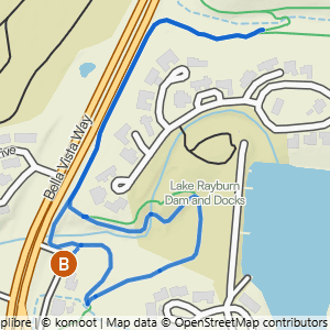
Bella Vista Museum to Lake Rayburn Waterfall 2
0.6 mi 3 · 50 ft gain 4 · 83 ft/mi 5 · Loop 6
Depending on the amount of recent rain, the waterfall may be too deep to safely cross without getting your shoes very wet. 8
- 1Difficulty → the badge color and label show the route’s level. Tap it on a real card to see what each level means
- 2Route name → tap it to open the route’s own page
- 3Distance → how far the whole hike is
- 4Gain → the total feet of climbing across the hike
- 5Steepness → feet of climbing per mile. Bigger numbers mean a steeper, tougher hike
- 6Route shape → a loop returns to where it started, an out & back turns around and retraces the same path, and a lollipop is a loop with a there-and-back stretch at one end
- 7Heads-up tags → things to know before you go, like a water crossing, a waterfall, or rocky ground. Not every route has them
- 8Route note → a tip about something specific on this route. Not every route has one
- 9View Route Details & Photos → opens the route’s page, with a photo walkthrough of the whole route, where to park, and the trails it uses
- 10View Trailhead Details → opens the trailhead page with parking details and directions
- 11View Route on Komoot → opens the route in the free Komoot app so you can follow it as you hike